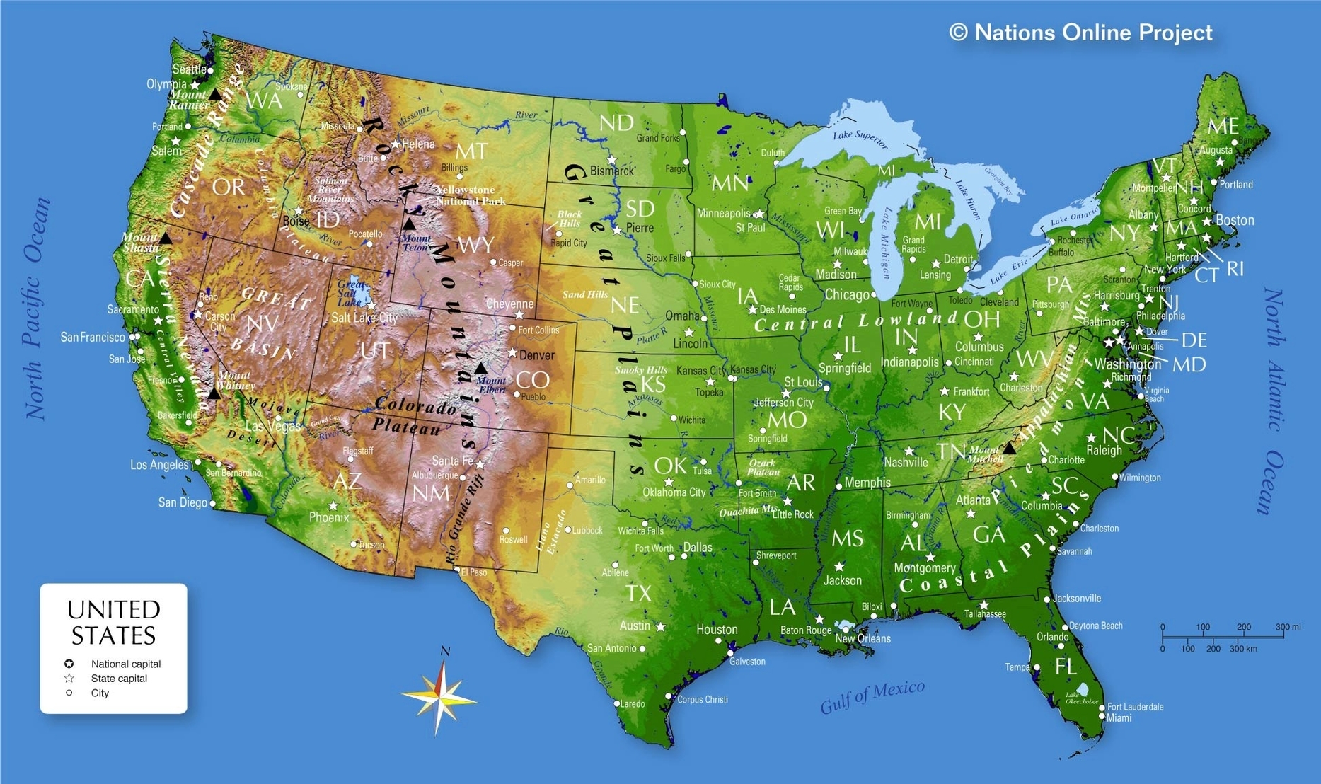
The United States of America is a vast country with a diverse geography. The country is located in North America, bordering both the North Atlantic Ocean and the North Pacific Ocean, between Mexico and Canada. The country has a total area of approximately 9.8 million square kilometers. The United States is divided into 50 states and one federal district, which is Washington D.C. Each state has its own capital city, and the country’s capital is Washington D.C. The United States is also home to several territories, including Puerto Rico, Guam, and the U.S. Virgin Islands.
The United States map is a fascinating representation of the country’s geography. The map shows the country’s borders, states, and major cities. The map also shows the country’s physical features, such as mountains, rivers, and lakes. The United States is home to several mountain ranges, including the Rocky Mountains, the Appalachian Mountains, and the Sierra Nevada Mountains. The country’s highest peak is Mount Denali, which is located in Alaska and stands at 20,310 feet tall.
The United States is also home to several major rivers, including the Mississippi River, the Colorado River, and the Missouri River. The country’s largest lake is Lake Superior, which is located on the border of the United States and Canada. The United States is also home to several other large lakes, including Lake Michigan, Lake Huron, and Lake Erie.
The United States map also shows the country’s major cities, including New York City, Los Angeles, Chicago, Houston, and Philadelphia. New York City is the largest city in the United States, with a population of over 8 million people. Los Angeles is the second-largest city in the United States, with a population of over 3.9 million people. Chicago is the third-largest city in the United States, with a population of over 2.7 million people.
The United States map also shows the country’s time zones. The United States has six time zones: Eastern Time, Central Time, Mountain Time, Pacific Time, Alaska Time, and Hawaii-Aleutian